AIS
ADS-B Station
I also run an ADS-B station to track aircraft across the UK and Ireland, feeding FlightRadar24 and other flight tracking networks.
AIS Station
AIS (Automatic Identification System) is an automated, VHF-based maritime tracking system used by commercial vessels, passenger ships, and recreational craft to broadcast real-time location and navigation telemetry.
Think of AIS as a digital marine safety beacon transmitted continuously from a vessel's onboard navigation and GPS systems.
Instead of relying strictly on coastal radar to scan the coastline, ships continuously broadcast high-frequency VHF radio signals on 161.975 MHz (Channel 87B / AIS 1) and 162.025 MHz (Channel 88B / AIS 2). Local receiver setups like mine - using an RTL-SDR v4 dongle paired with a Raspberry Pi - capture these weak radio signals directly from the air as vessels navigate local waters.
When a packet is received, the raw maritime telemetry is decoded locally using AIS-catcher software and fed directly to global tracking networks like ShipXplorer, AIS Hub, and the wider AIS-catcher community. This data is combined with feeds from thousands of other shore stations around the world to build a live, global map of maritime traffic.
Because VHF radio operates on line-of-sight propagation, placing an antenna at a good elevation makes all the difference. My antenna setup at roughly 100m above MSL (located pointing out to sea) allows me to capture maritime traffic tens of nautical miles out to sea, picking up continuous vessel updates directly from transponders on the water. My station helps fill coastal blind spots and feeds local vessel movements into the global tracking grid.
Unlike satellite-only tracking which updates intermittently, ground-based VHF radio tracking picks up live signals in real time, allowing shore stations like mine to process vessel updates completely independent of central harbour control infrastructure.
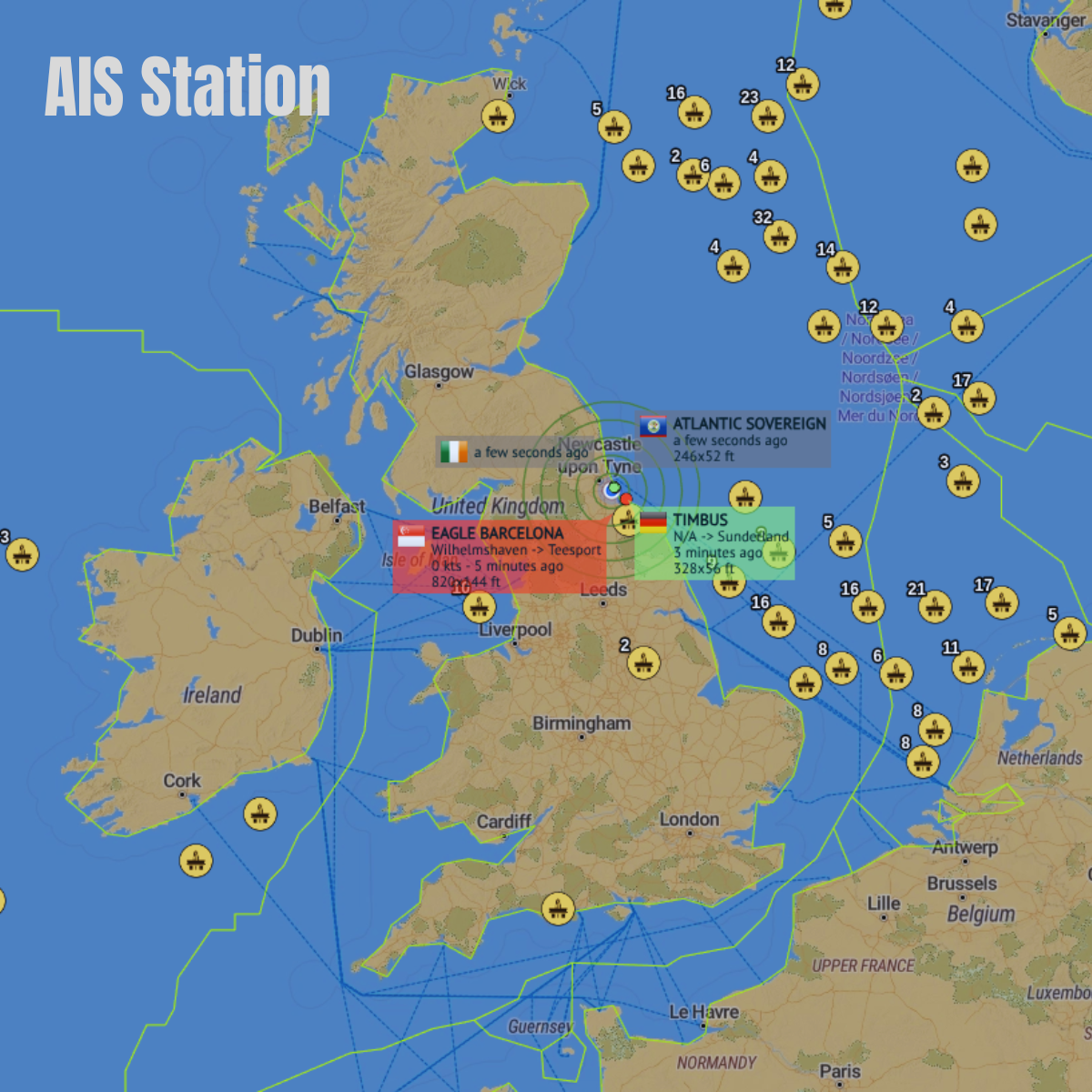
ShipXplorer Station Coverage
What is in an AIS Message?
- Vessel Identification & Static Data
- MMSI (Maritime Mobile Service Identity): Unique 9-digit identification number assigned to the vessel.
- IMO Number & Callsign: Permanent ship identification number and official radio callsign.
- Vessel Name & Type: Vessel identifier and category (e.g., Cargo, Tanker, Passenger, Tug, Fishing).
- Dimensions & Antenna Location: Length, beam, and exact GPS antenna placement relative to the hull.
- Dynamic Navigation Data
- Latitude & Longitude: High-precision GPS coordinates transmitted at frequent intervals.
- Speed Over Ground (SOG): Current vessel speed calculated via onboard GNSS.
- Course Over Ground (COG) & True Heading: Exact movement vector and compass direction of the ship's bow.
- Navigational Status: Current vessel state (e.g., Under Way Using Engine, At Anchor, Constrained by Draught, Moored).
- Rate of Turn (ROT): Speed at which the ship is changing direction (degrees per minute).
- Voyage & Operational Data
- Destination & ETA: Declared port of destination and estimated timeof arrival (UTC).
- Draught: Current underwater depth/submersion level of the hull.
- Hazardous Cargo Status: Operational indicators for dangerous goods or pollutant cargo onboard.
- Safety & Emergency Broadcasts
- Safety-Related Text Messages: Free-text navigational warnings or distress alerts transmitted across marine frequencies.
- AIS-SART / EPIRB Transmissions: Search and Rescue transponder distress bursts for emergency localisation.